
In eastern Türkiye near Mount Ararat, a team of researchers is preparing to send a custom underground robot into a boat-shaped hill that some believe could be the resting place of Noah’s Ark, turning decades of fringe fascination into a high-tech, government‑approved probe of one of history’s most enduring geek myths. The Noah’s Ark Scans expedition has moved from speculation and radar scans into core drilling and robotic exploration at the Durupinar formation in Ağrı Province.
The Durupinar formation is a roughly 150‑meter‑long, keel‑like mound located about 29 kilometers south of Mount Ararat, long touted by Biblical literalists as a potential Ark site and dismissed by many geologists as a natural mudflow or erosional feature. The structure was first identified in 1959 from aerial photographs, sparking a wave of Ark‑hunter expeditions and documentary specials that turned the hill into a pop‑culture regular for “ancient mysteries” programming. Over the years, various teams have run ground‑penetrating radar across the site, claiming to see right angles, “rib‑like” patterns, and internal chambers beneath the surface, while mainstream researchers cautioned that radar anomalies are not the same thing as preserved timbers.
The current project is notably different in that it operates under official permits from Turkish authorities and in collaboration with local universities, including work led by archaeologist Prof. Dr. Cenker Atila of Sivas Cumhuriyet University. According to Noah’s Ark Scans, the team includes American scientists, geologists, and archaeologists and is billed as the most comprehensive geophysical and geological survey of Durupinar to date. They have already begun drilling narrow cores down to depths of around 18 meters, collecting material for chemical and sediment analysis while building a subsurface map of the formation using ground‑penetrating radar (GPR), electrical resistivity tomography (ERT), LiDAR, and related imaging tech familiar to anyone who geeks out over real‑world dungeon‑mapping tools.
Those scans reportedly show organized voids, tunnels, and corridor‑like spaces, including one anomaly described as a hallway stretching more than 250 feet beneath the surface, which the team hopes to inspect directly. In one early core run, a drill bit allegedly shattered when it impacted what researchers say could be a harder layer, possibly petrified wood, though that interpretation will need to be backed by lab analysis rather than Ark‑hunter hype. Samples pulled from the cores are being cataloged for petrographic study and chemical testing, with the goal of determining whether the formation is entirely geological or includes any evidence of ancient human construction.
The expedition’s most sci‑fi piece of hardware is “Gopher,” a specialized underground exploration robot repurposed from wildlife research by Australian engineer Robert Ross and outfitted for spelunking spaces too tight or unstable for human entry. Once drilling opens access to mapped voids, Gopher is slated to be lowered through the cores to roam those cavities, capturing high‑resolution video, environmental readings, and, where possible, small samples from interior surfaces. The robot effectively turns Durupinar into a real‑world dungeon crawl, swapping torches and rope for cameras and sensor suites in a bid to see whether those radar anomalies are natural fissures, sediment pockets, or something more architecturally suggestive.
All of this tech comes with a price tag: project organizers have publicly stated they need roughly $600,000 to fund drilling operations, robot deployment, and extended analysis, leaning on donations and media coverage to keep the search going. Some promotional rhetoric from supporters frames the work as a potential blow to evolutionary science—one British tabloid highlighted a claim that “Darwinism will be dismantled” if an Ark‑like structure is confirmed—fueling criticism that the project blurs science with apologetics. At the same time, official statements from Noah’s Ark Scans stress permits, peer collaboration, and rigorous methods, positioning the expedition as a test case for whether controversial biblical‑archaeology sites can be studied with mainstream tools while still appealing to faith‑driven audiences.
Image Credits
In-Article Image Credits
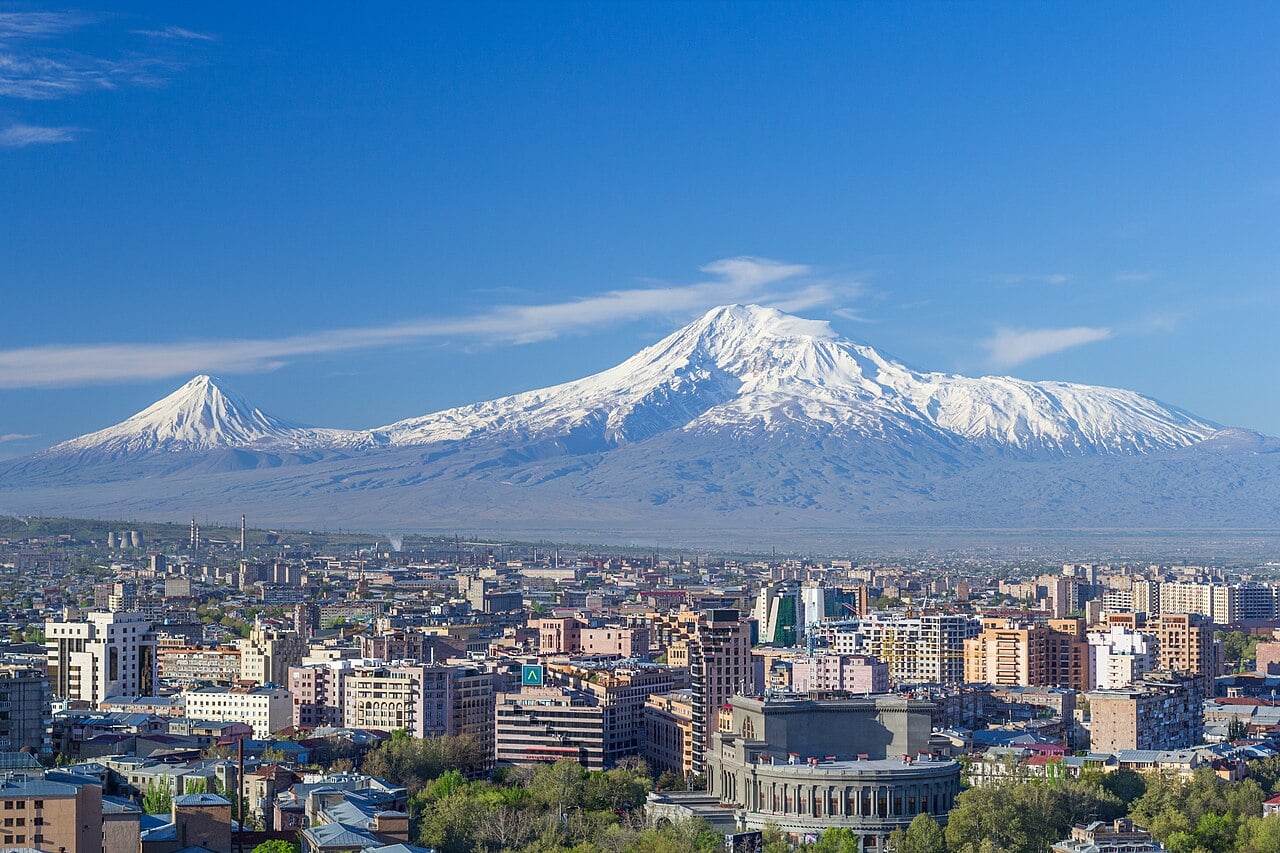
Mount Ararat and the Yerevan skyline in spring. The Opera house is visible in the bottom right. via Wikimedia Commons by Serouj Ourishian with usage type - Creative Commons LicenseFeatured Image Credit
Mount Ararat and the Yerevan skyline in spring. The Opera house is visible in the bottom right. via Wikimedia Commons by Serouj Ourishian with usage type - Creative Commons License


